Why this Polis-Inventory app?
The unmet need driving the creation of the Polis-Inventory app is described.
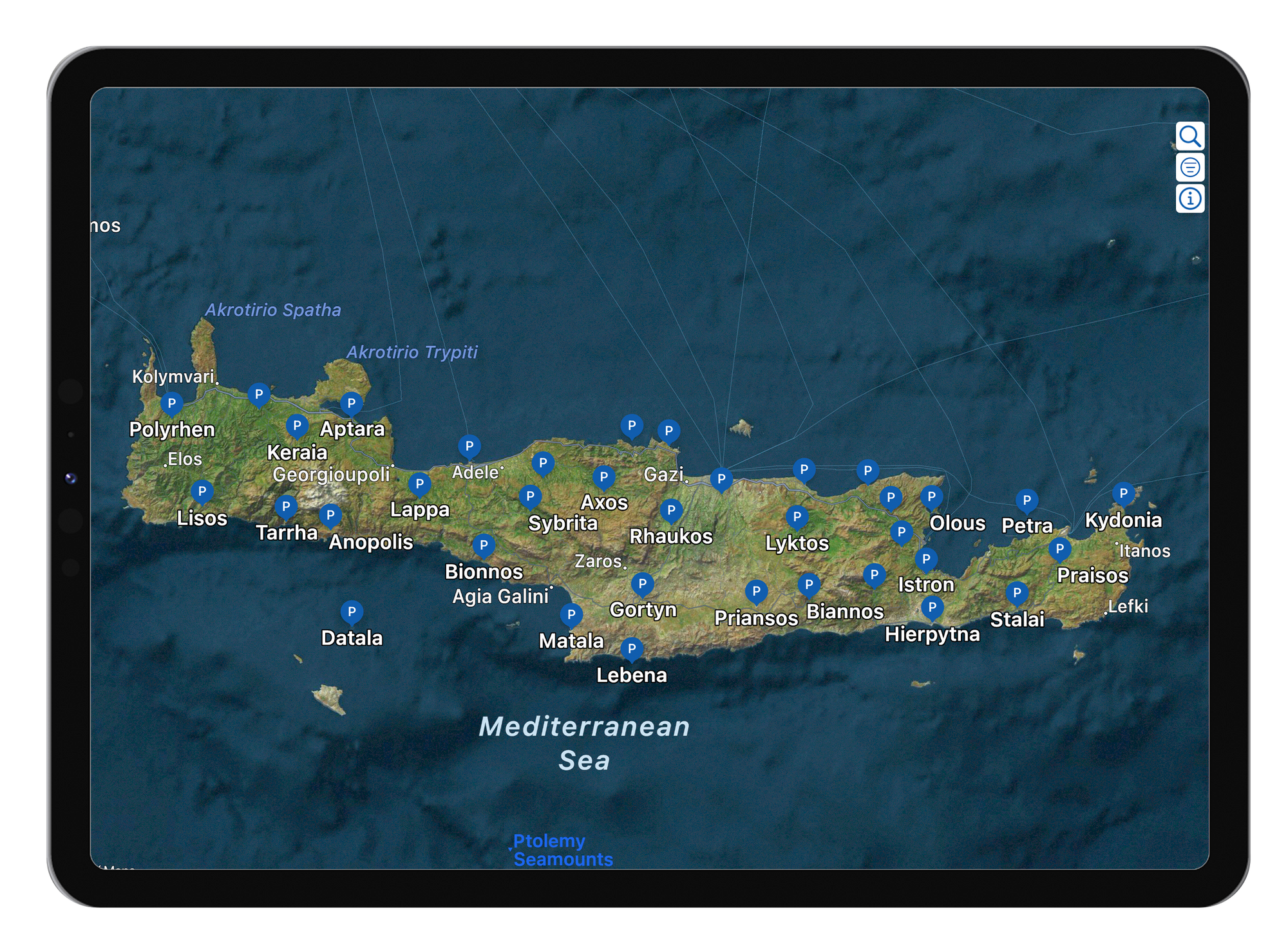
Upon first discovery of An Inventory of Archaic and Classical Poleis by Hansen & Neilsen one is easily excited to find such a treasure trove of information about these ancient Greek communities. Quickly, however, one might realize there is a glaring omission. There are no maps to guide the reader on where each polis is located or its geographical relationship with other poleis.
Reading further one learns that, rather than create and publish their own maps, the authors referenced the Barrington Atlas Of The Greek And Roman World, edited by R. Talbert. And this is quite understandable; to say the Barrington Atlas is a phenomenal and serious reference is an understatement. Yet, it is a paper atlas and the Inventory directs you to the page in the atlas on which you will find the location of the polis if you look for it (you can find a digital version of the Barrington Atlas on the Apple app store here, but the problem remains).
Therefore, the purpose of the Polis-Inventory app is to fill the gap between the Inventory and the Barrington Atlas. To provide the missing visual whereby you can seamlessly explore the geographic extent of the poleis superimposed on modern satellite imagery.
As a result, the Polis-Inventory map-based app is interactive and informative, allowing for visualization, searching, and filtering of the poleis based on its named set of physical and historical parameters.
And, being published on the Apple platform, free of charge, available on the iPhone, iPad and MacOS, the app can be easily used as an in-situ field / travel reference and in a desktop-oriented research environment.
The Polis-Inventor app is designed to be a companion to the Inventory with the aim of augmenting and enhancing one’s consumption of the Inventory.