The Polis Inventory App
An introduction to the Polis-Inventory app including a description of function and features.
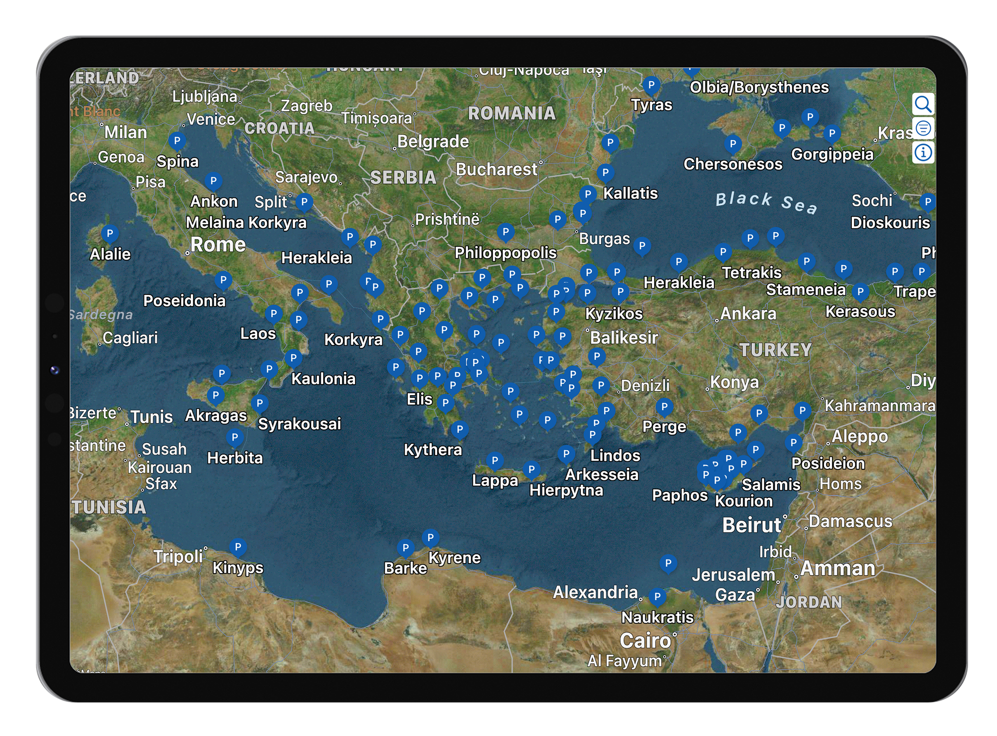
The Polis-Inventory app maps the 1035 poleis superimposed upon modern digital satellite images. A user may explore the map spatially by panning and zooming. Selecting a specific polis presents a summary of the named data about each polis. Using the search pane, one may directly navigate to a particular polis. A set of data filters are also available to narrow the dataset, for example to see the set of poleis located above a given elevation or those with evidence of fortification, and so forth.
The app is available on the iPhone, iPad and Mac. The screen shots that follow are taken from renditions of the iPhone and iPad.
Explore
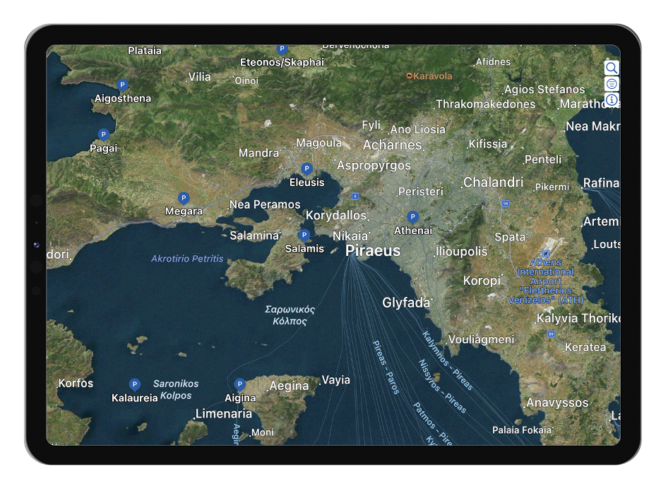
Zoom and pan to interactively locate poleis on the map as indicated by the blue P(olis) markers. Each marker displays the name of the polis underneath.
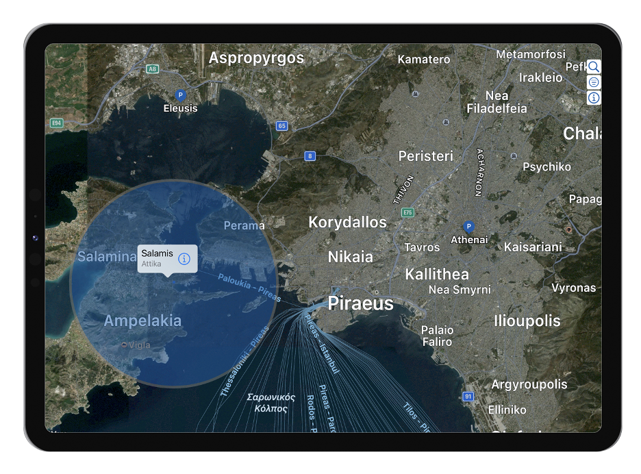
Tap on a marker to produce the caption view. In addition to the city name, the caption shows the region’s name, and an overlay also appears (blue circle) that depicts the spatial of Influence (size) of the city as reported by the Inventory. In the cases where the city Influence is unknown, the blue circle turns white. For the cities with very large or unbounded Influence the gray enclosing band is removed.
Polis Detail Pane
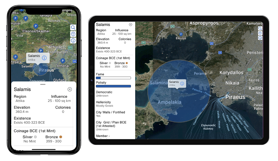
Tapping the caption will launch the city Detail Pane that displays the named set of physical and historical parameters for that city, as described in the Inventory.
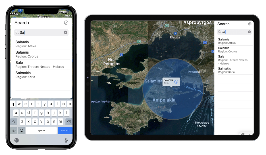
Search Pane
To lookup a city by name you can use the Search Pane. Type in a name and tap the cell where it appears, and the map will “fly” over to it.
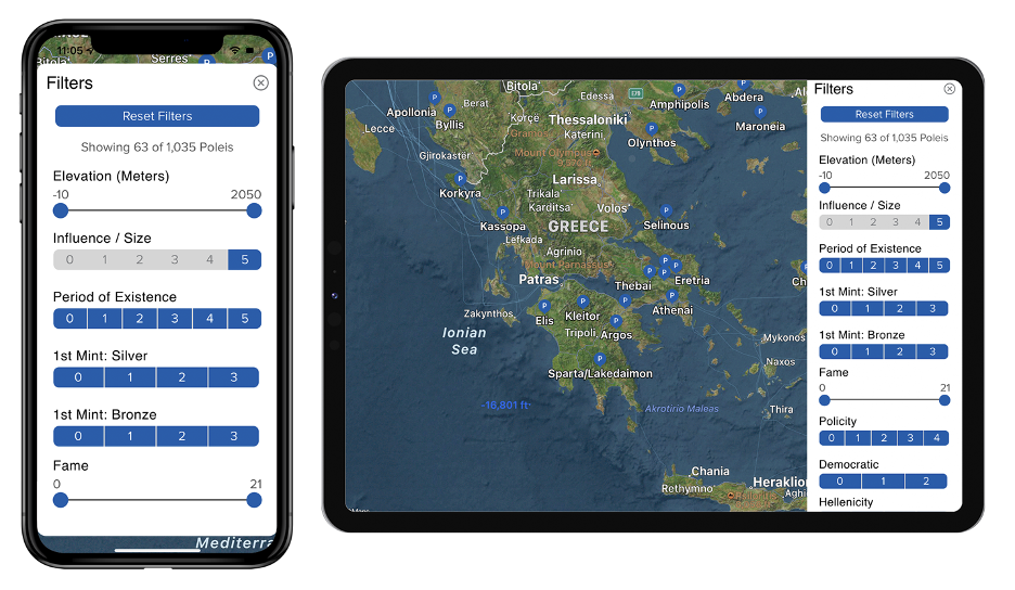
Filter Pane
For deeper exploration of the dataset, filters are provided for each parameter listed in the Detail Pane. Use the filters to narrow the dataset to an area of interest. Tap the reset button to remove all filters
Info Pane
The Key of Terms Tab
A Key of terms (below left) and their associated filter ranges for all parameters can be found on the first tab of the Info Pane.
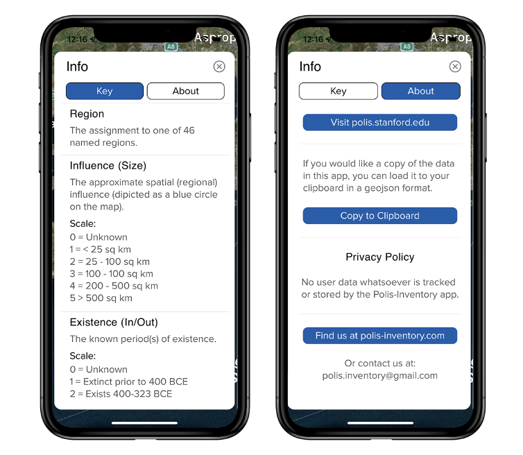
The About Tab
The About tab (above right) includes important references and accreditations regarding the data that include a link to the Sanford University site polis.stanford.edu. You will also find a button that will allow you to copy the data to your clipboard in a GeoJSON format.